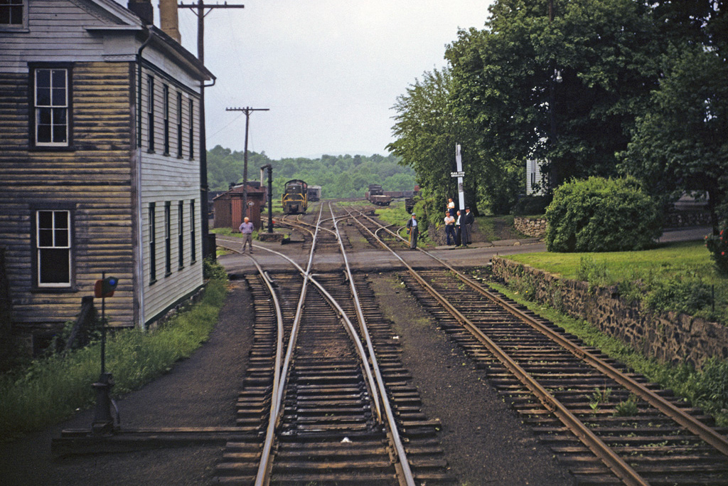
The view behind as locals watch one of the last steam moves on the CNJ pull a special through town.
Comments:
The road in the foreground is current Rte. 513 / W.Main St. High Bridge. The yard is now the town commons park. Those stone walls are still there, as are the houses. The house on the left was the home of a woman who was the foreman of the branch track gang for many years. The track on the left (as noted, the east leg of the wye) is still in place. It forms the "bumper" for the commons parking lot. It curves around toward the NJT station, crossing a short bridge over the lead that went down to the Taylor-Wharton facility. There is a switch frog on top of that bridge that leads to the old Robert A. Apgar coal dock that is still in place and in use as a storage shed for a swimming pool supply company.
Great shot but as you're probably been advised, this photo was taken in High Bridge NJ. track to the left is the east leg of the wye located there, with the western leg of the wye (and yard) and connection with the mainline (westbound) directly ahead of you.